Remote Location Scouting: How to Preview Film Sets from Your Desk
Scout 50 filming locations worldwide in one afternoon without leaving your office. Perfect for location managers, directors, and producers.
The Challenge
Location scouts spend weeks traveling to preview potential filming sites, burning through thousands in travel costs—only to find most locations don't work. Directors can't visualize setups without expensive site visits.
The Solution
GenAerial lets you scout globally from your desk. Generate cinematic aerial views of any GPS coordinate—beaches in Thailand, deserts in Morocco, cities in Europe—all within minutes. Shortlist locations before spending a dollar on travel.
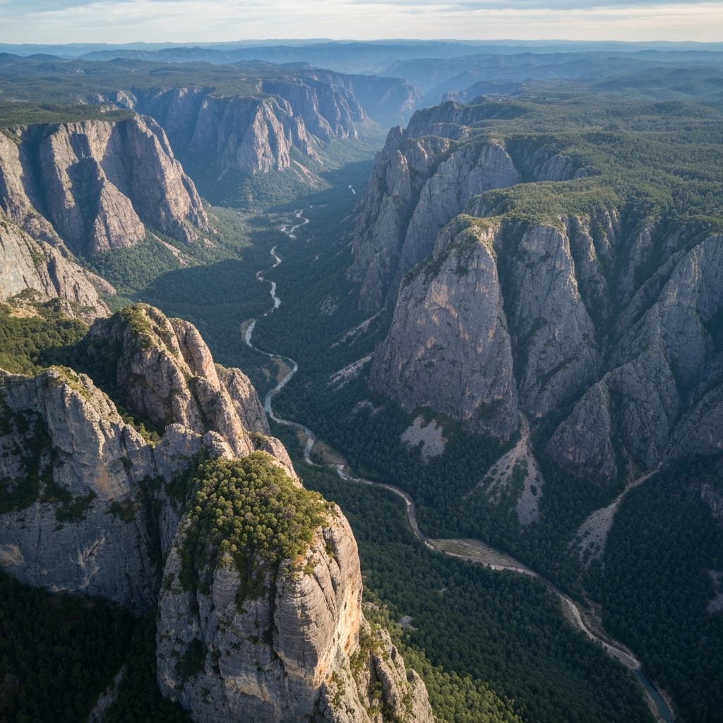
Why Professionals Choose GenAerial
Transform your film, media & content creation workflow with instant, professional aerial imagery
Scout the Entire World from Your Office
Need a dramatic coastline? Check 20 locations across Portugal, Ireland, New Zealand, and Chile in one morning. Compare light angles, accessibility, and nearby infrastructure before booking a single flight.
Eliminate Wasteful Scout Trips
Traditional scouting sends teams to 15 locations, shoots 8, and uses 2. With GenAerial, eliminate bad options during pre-production. Only fly your team to the final 3-5 contenders, saving $15K-30K per production.
Present Options to Directors Faster
Producer asks for 'mountain lake with road access' on Monday morning? Have 10 viable options with aerial views by Monday afternoon. Make creative decisions faster without waiting weeks for scout reports.
Pre-Visualize Shots Before Arrival
Show your director what the establishing shot will look like from each potential location. Test different times of day with golden hour settings. Make informed creative decisions before crew call.
How It Works
Three simple steps to professional aerial photography
Define Your Location Requirements
Identify 15-30 potential locations worldwide using digital tools, film commission databases, or local knowledge. Compile GPS coordinates for each candidate.
Generate Cinematic Aerial Previews
Create aerial views from multiple angles and altitudes for each location. Test different lighting (golden hour, overcast, bright) to assess visual appeal for your specific scene requirements.
Share with Creative Team & Shortlist
Present aerial views to directors, producers, and DPs in a consolidated deck. Eliminate locations that don't meet visual or logistical requirements. Schedule physical scouts only for top 3-5 finalists.
Example Applications
See how GenAerial could transform your film, media & content creation workflow
Period Drama European Locations
Director wanted 'untouched medieval village' for $8M period film but couldn't afford to scout 40 potential locations across France, Spain, and Italy
Generated aerial views of 40 pre-identified villages in 3 days, eliminating 32 that had modern development visible from aerial angles
Narrowed to 8 locations, scouted 5 in-person, selected 2 for filming—saved $28K in scouting costs, found perfect locations faster
Action Film Desert Sequences
Production needed desert location with road access for vehicle stunts but safe distance from populated areas for pyrotechnics
Scouted 60 desert locations across Nevada, New Mexico, and Utah using aerial views showing roads, proximity to towns, and ground conditions
Identified 3 ideal sites remotely; one became primary location—saved 2 weeks of physical scouting
Documentary Series on Coastal Climate Change
8-episode series needed coastal locations showing development encroachment—budget couldn't support international travel for pre-production
Generated aerial views of 85 coastal sites across 6 continents showing development patterns and erosion concerns
Selected 24 filming locations remotely; field producers confirmed suitability 95% of time—completed entire series scout in 2 months vs projected 6 months
Everything You Need
Professional features for film, media & content creation
Frequently Asked Questions
Can I use these aerial views in pitch decks and lookbooks?
Absolutely! Many producers include GenAerial shots in pitch presentations to show investors and studios what the film will look like visually. Just disclose that they're AI-generated previews, not actual photography from the production.
How do these compare to sending a drone operator on a scout?
GenAerial is perfect for the pre-pre-production phase—eliminating bad locations before spending money on scouts. Once you've narrowed to your top 3-5 locations, that's when you send your DP and drone operator for actual photography. Use GenAerial to get to 80% confidence before spending money on travel.
Can I see seasonal variations of locations?
GenAerial can generate different lighting and weather conditions, though seasonal landscape changes (spring green vs. fall colors) may not be fully represented. For critical seasonal decisions, you may still need to scout in the specific season you plan to shoot.
Will these show current construction or recent development?
GenAerial uses high-fidelity AI generation. For fast-changing areas, some very new developments might not appear. This is usually fine for remote scouting to establish viability—you'd still do a final physical scout before committing to a location.
Can I assess sun angles and shadows for specific times of year?
GenAerial can show different lighting conditions (golden hour, midday, overcast). For precise sun path analysis for specific shooting dates, you'd use dedicated sun path tools (like Sun Surveyor) in conjunction with our aerial views.
Do film commissions accept these for location incentive applications?
Check with specific film commissions, as requirements vary. GenAerial is typically used for internal creative decisions and preliminary location reports. For official incentive applications, commissions usually require actual photography from physical scouts with proper documentation.
Ready to Scout the World from Your Desk?
Join 150+ production companies using AI aerials for faster, cheaper location scouting